
Mobility study · Saint-Médard-en-Jalles, France
Five kilometres of tram through protected landscapes, to the heart of Saint-Médard.
Bordeaux Métropole is extending tram line D from Cantinolle to the centre of Saint-Médard-en-Jalles, to serve four communities west of Bordeaux. The line follows a main road, crosses wetlands and a river, and ends at a town square. The team studied the route, the stations and their surroundings, up to preliminary design. Signes Archi shaped how the line sits in streets, stations and landscape.
Client
Bordeaux Métropole
Funder
Bordeaux Métropole
Team
Artelia (lead), Signes Paysages, SUEZ Consulting, Let’s Grow, Signes Archi
Site
Saint-Médard-en-Jalles, Le Haillan, Eysines, Le Taillan-Médoc (Gironde), France
Length
About 5 km, mostly single track, with 5 new stations
Budget
€85 M excl. tax for the whole operation, of which €64 M for works (January 2018 values)
Timeline
Studies from November 2018 to end 2020
Status
Preliminary studies and preliminary design completed. The next phase is to be scheduled by the client.
The site
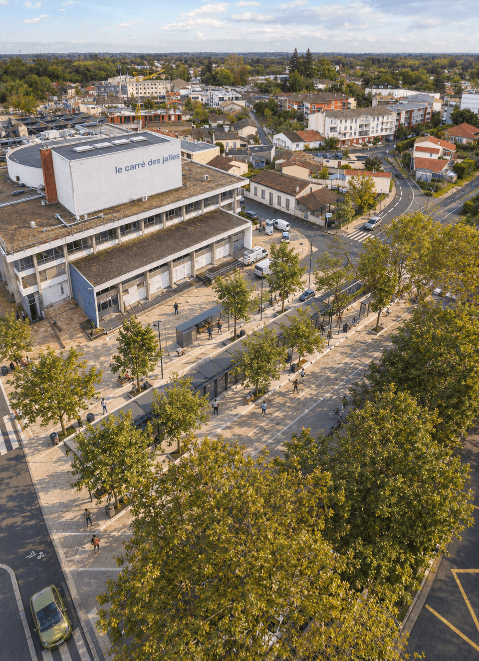
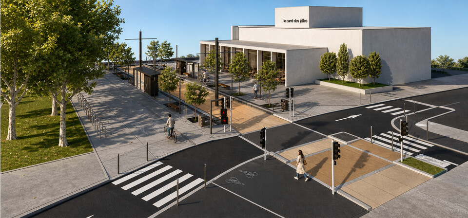
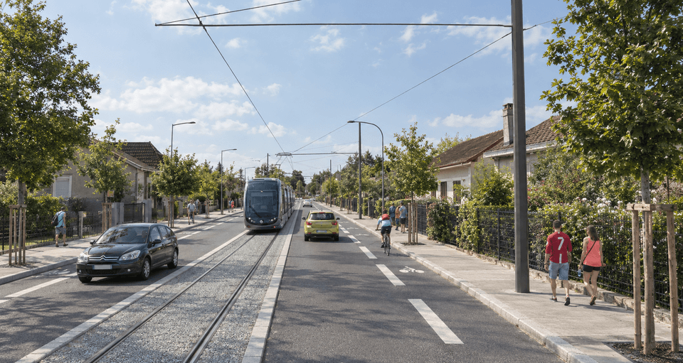
The extension starts at Cantinolle, the end of tram line D, beside a shopping area that is being rebuilt and next to the tall Taillan aqueduct and a wetland. It then follows the Route de Lacanau (RD1215) for about 2.5 km through the wooded strip beside the road, crosses the Jalle river, and reaches Saint-Médard-en-Jalles. There the tram enters town along avenue de la Boétie and rue Paul Dethomas, runs beside the Bordeaux–Lacanau cycle path, and ends near Place de la République, at the Carré des Jalles station. Along the route the surroundings change from an edge-of-town entrance, to a main road, to a dense street with a market and a school, to a quiet cycle path.
The challenge
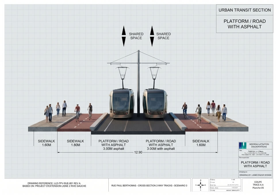
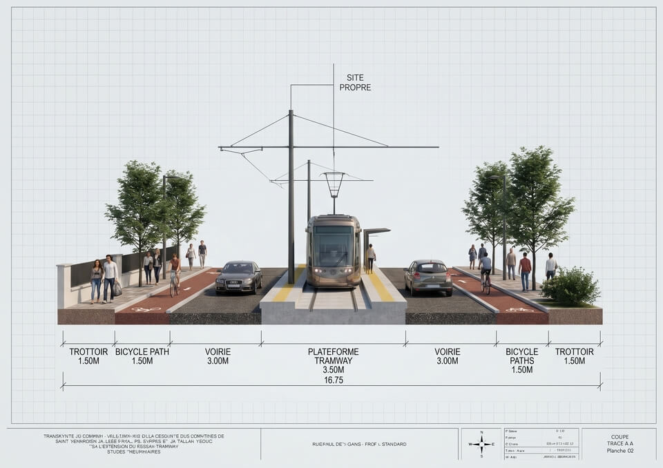
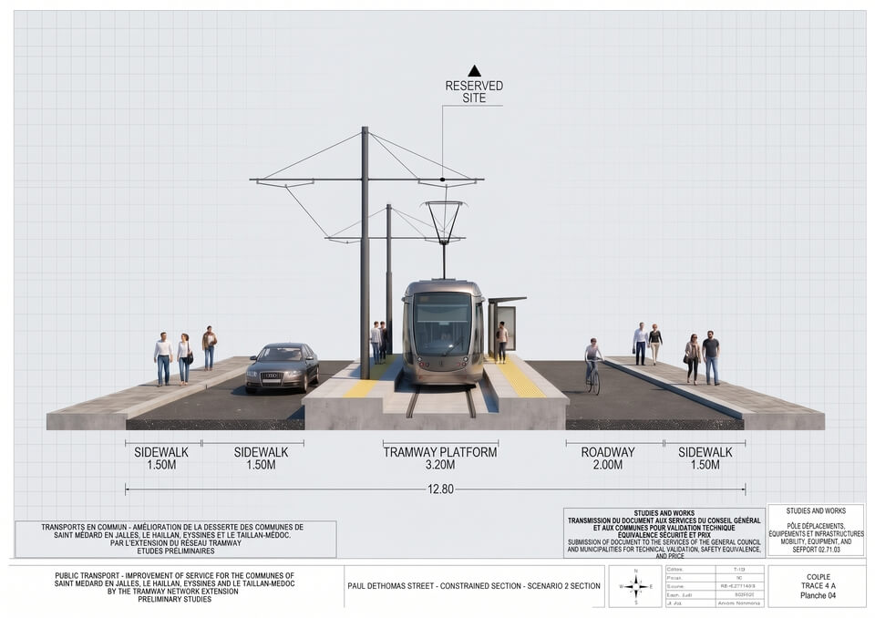
Each stretch asks for a different answer. On the RD1215, a 90 km/h road, a single-track tram at 70 km/h and a cycle and footpath have to share the space safely. The route runs past drinking-water sources, a flood zone, a classified wood and a protected church setting. In town, parking, homes and a school sit on a street only about 15 m wide. At the terminus, the tram arrives at the back of a square, so the station has to be read as part of a wider public space, not just a stop.
The programme
The client asked for an extension of tram line D to Saint-Médard, with five new stations (Chai, Germignan, Boétie, Paul Dethomas and the Carré des Jalles terminus), street and public-space works beside the line, public lighting, two park-and-ride sites of at least 250 spaces each, a multimodal exchange hub at Germignan, a restructured bus network, and more storage capacity at the La Jallère depot. The design also had to leave room for the RD1215 to be widened later, and for a later extension of the line towards the west of Saint-Médard.
Consultation
The client held a public consultation from December 2016, and approved its outcome in March 2018. The team was asked to support public consultation and information.
Mission of the team
Complete project management (design and construction supervision).
- Preliminary studies and preliminary design, up to the public-inquiry file: route variants, number and position of the stations, cross-sections, cost estimates
- Detailed design, tender documents and supervision of the works
- Technical systems: traction power, signalling, overhead line and station equipment
- Transport and parking studies, including the multimodal hub at Germignan
- Survey and synthesis of utility networks, and coordination of their diversion
- Administrative files and procedures (APA)
- Public consultation and information support (ACI)
- Planning and coordination of studies and works with all third parties, quality plan and as-built files
Mission of Signes Archi
- Typical cross-sections of street and tram platform
- Station location, number and typical layouts, with their equipment and furniture
- Street furniture, public lighting and surface finishes
- Green spaces and street-tree planting, with a proposed palette of species
- Cycle paths, bike shelters, pedestrian crossings, parking and the park-and-ride sites
- Effect on the buildings next to the line, and rebuilding of fences and accesses
- Building and development permit applications
- 3D images and photomontages for the public consultation
Scope and themes: Strategy, studies and planning · Design · Permits and approvals · 3D, BIM visualization and films
Test page. Schematic map redrawn from the route and stations; not to scale.